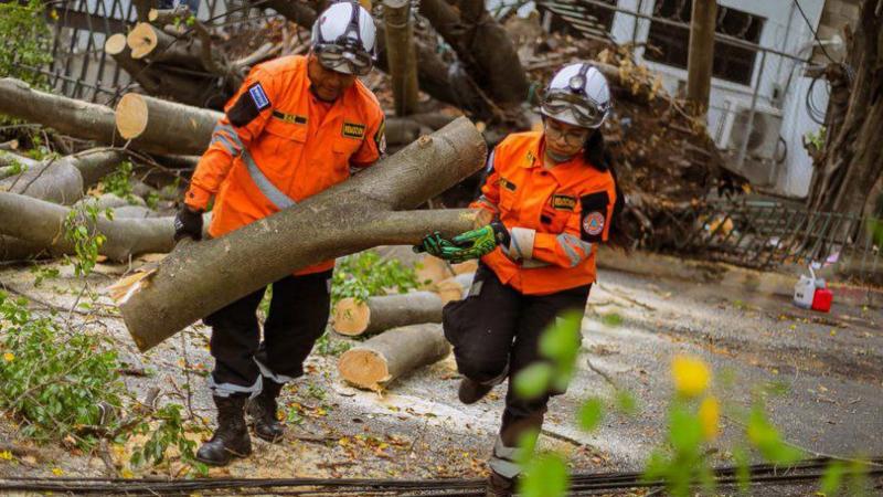
The Ministry of Environment warned that urban flooding, flash floods and river overflows, landslides, and slope slides may occur. In addition to fallen branches, trees, billboards and other susceptible elements on wet soil.
this rain The storm affecting the country will continue until Friday, so people should bring umbrellas, parasols or other protective equipment to avoid getting wet and contracting any illness.
The Ministry of Environment and Natural Resources (MARN) reported that the rains and storms were caused by the approach of the Intertropical Convergence Zone and the remnants of Tropical Depression 21, which could form a new low pressure system when interacting with the Pacific Ocean.
He added that the remnants of Tropical Depression 21 (DT-21) will continue to cause instability in Nicaragua, Honduras and El Salvador, creating favorable conditions for the formation of moderate to severe clouds, showers and storms during Wednesday, Thursday and Thursday. . Friday..
Also read: Body of young man dragged through Avachapan Canyon found in San Lorenzo
“As this instability (the remnants of DT-21) or disturbance interacts with the Pacific Ocean, a new low pressure system or tropical cyclone may form, with a 20% probability of lasting 24 to 48 hours, and within two to five days “That is, as of Friday, there is an estimated 70 percent chance of formation near the coast of El Salvador, Guatemala, or the Bay of Tehuantepec,” the government agency’s Meteorological Special Report No. 7 states.
He added that in the next 24 hours, attention and monitoring are recommended as the probability of urban flooding and flash flood-related impacts are high (60% – 80%) and medium (30% – 60%) respectively. River overflows, landslides and slope slides, as well as fallen branches, trees, billboards and other susceptible elements located on wet soil.
Some people, mainly in the western part of the country, said they felt hot at certain times of the day; but then it was cold.
In view of this, critical care physician Emilio Salazar recently pointed out that as the temperature changes, people are prone to respiratory diseases, such as influenza, influenza, bronchitis, etc.
The most vulnerable are pregnant women, children under 5 years old, and adults over 65 years old, who mainly suffer from chronic diseases such as diabetes, hypertension, obesity, and kidney failure.
Therefore, he recommends avoiding sudden changes in temperature and airflow.
The Ministry of Health’s epidemiological bulletin corresponding to week 41 shows that compared with week 41 of 2023, there were 30,563 cases of acute respiratory infection (ARI) per 100,000 inhabitants, compared with the same period in 2022 (22,796 per 100,000 inhabitants). Example) case of acute respiratory infection (ARI) infection. 100,000 inhabitants), with a significant difference in the rate of 7,767 cases per 100,000 inhabitants. In other words, cases of acute respiratory infections have increased.
Showers and storms are expected to develop at various points in the northern highlands and volcanic belt starting from midday on Wednesday and throughout the afternoon, the Environment Department said.
During the night, there will be more organized storms forming in the east and moving westward toward the coast and parts of the quasi-central or central area.
you might be interested: They identify a mother and her child who died from a lightning strike in Jujutla
And Thursday morning, “skies will vary between clear and lightly cloudy. Showers and storms are expected in the afternoon and evening, with some intensifying overnight. They are expected to form high in the mountains and volcanoes in the afternoon and move toward the surrounding areas.” The area extends and moves into the east during the night, towards the coast and quasi-central areas. No major changes in winds and temperatures are expected,” the environment ministry added.

