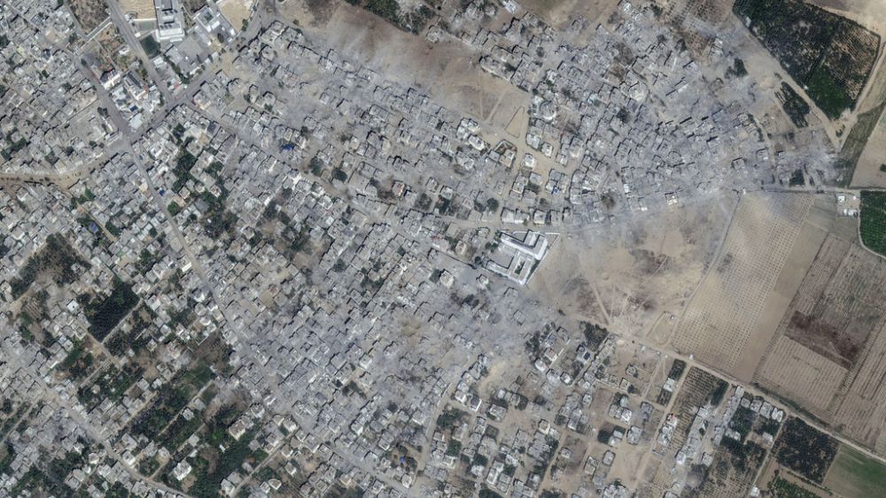
Israeli air strikes destroyed all settlements in northern Gaza. Satellite images published by technology company Maxar show the city before and after the attacks.
Three weeks after the Israeli bombing began, space technology company Maxar released satellite images showing the extent of the devastation in Gaza.
According to the Palestinian Ministry of Health in Gaza, the number of Palestinians killed in devastating air strikes launched by Israel in response to the Hamas attack on October 7, which killed 1,400 people and took at least 200 hostage, has exceeded 7,000.
The aerial bombardments, which have destroyed settlements, have caused death and destruction on a level not seen in the last four conflicts between Israel and Hamas.
More than a million people were forced to flee their homes, with many families following Israeli orders to “evacuate south” in light of ongoing Israeli attacks in the besieged area.
The buildings shown on the right side of the images disappear after the attack, turning into piles of dust and rubble.
Beit Hanoun town, northern Gaza Strip; The first photo above is from October 10th and the second is from October 21st.
A site of 13 high-rise buildings near the sea near the Beach refugee camp in Gaza has been reduced to a pile of dust, leaving only the skeletons of the buildings standing, according to satellite images taken by Maxar Technologies.
Arguing that only militants were targeted in the attacks, Israel accuses Hamas of hiding among civilians to protect its fighters.
The Israeli military announced that Shadi Baroud, head of Hamas’ intelligence unit and one of the planners of the October 7 massacre, was killed in an airstrike.
On the other hand, Hamas fighters have fired thousands of rockets at Israel since the beginning of the war.
The above satellite image of the city of Al-Atatreh in the city of Beit Lahia in the northern Gaza Strip. The first photo is dated May 10 and the second is dated October 21.
The first satellite images of the Karama area, located on the sea north of the Gaza Strip, were taken on May 10, and the second on October 21.
In Gaza, stocks of food, medicine and fuel needed to operate emergency generators have reached critical levels.
The United Nations Relief Agency for Palestine Refugees (UNRWA), which is responsible for meeting the basic needs of hundreds of thousands of residents, warns that fuel may run out within a few days.
In the above photos of the town of Beit Hanoun in the northern Gaza Strip, the photo on the right shows May 11, and the photo on the left shows (after) the destruction that occurred on October 21.
In recent days, Israel has allowed more than 70 trucks carrying aid from Egypt to Gaza to cross into Gaza through the Rafah border crossing, the only entry point outside Tel Aviv’s control.
But aid workers say these convoys meet only a small part of the region’s growing humanitarian needs. Before the war, an average of 500 trucks carried aid to Gaza daily.
(Tags for translation)Hamas

